[17:54 Sun,24.November 2024 by Thomas Richter] |
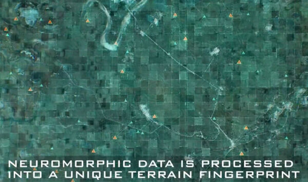
Drones use the precise determination of flight coordinates via GPS for many purposes, such as pre-planned flight paths using waypoint navigation, returning to the starting position, transmitting the exact position in real time (e.g., to the flight app), avoiding restricted areas, preventing collisions, and recording the flight route. For GPS to work, several GPS satellites must be within line of sight so that the drone can receive their signals and calculate its position. But what should you do when GPS reception is disrupted, whether due to intentional jamming or because the GPS satellite signals cannot reach the drone due to obstacles like buildings or vegetation?  The alternatives available so far are automated visual navigation systems that use a camera to match the characteristics of the terrain being flown over with an internal map and inertial navigation systems (INS) with accelerometers and gyroscopes. These systems continuously measure the relative flight direction and acceleration (or speed) to estimate where a drone has moved from a predetermined starting point. However, both systems have significant disadvantages compared to GPS: the former are very memory- and computationally intensive due to the large amount of visual information, while the latter accumulate small measurement errors that quickly lead to larger inaccuracies in position determination. For this reason, GPS has so far been indispensable for navigation systems in smaller and more cost-effective drones. Two companies, NILEQ from the UK and Advanced Navigation from Australia, now want to change that. They aim to combine visual navigation using a neuromorphic camera with a fiber-optic inertial navigation system into a cost-effective navigation system that can accurately determine its position even over long distances.  The neuromorphic camera is inspired by the functionality of the human retina and therefore works fundamentally differently from conventional cameras: instead of capturing individual images, it outputs the brightness changes of individual pixels. An algorithm uses this data to create so-called "terrain fingerprints," which are compared in real time with a pre-installed satellite image database. This approach allows for precise position determination with minimal computational effort, and the database size remains negligible. This results in a significantly more affordable system for visual navigation than previously available options. The visual navigation system can provide the INS with highly accurate position updates at regular intervals, allowing it to recalibrate its position. Currently, neuromorphic cameras cannot yet work with infrared data and therefore do not function at night—however, neuromorphic infrared cameras are under development and are expected to be available within the next few years. At the moment, neuromorphic cameras cost around 1,000, but the INS system is much cheaper, making the overall navigation system much more affordable than existing alternatives. Additionally, as is often the case, production costs tend to drop quickly as production volumes increase, which means the system could become feasible for more and more drones. The two companies plan to launch their new sensor in mid-2025—we’re curious to see when the first of these systems will be used in a (semi-)professional camera drone. Bild zur Newsmeldung:
deutsche Version dieser Seite: Empfangsstörungen adé - Neuromorphe Kamera ersetzt GPS |


