

[12:16 Thu,14.January 2021 by Thomas Richter] |
The free Droniq app is the successor to the DFS app, which will become inactive on 31.12.2020 when the new EU regulation comes into force, and is thus effectively the official app for questions relating to (legal) drone safety. The Droniq app is designed to help pilots comply with applicable laws and regulations and not endanger anyone unnecessarily. Behind the app is Droniq GmbH, which is a joint venture of DFS (Deutsche Flugsicherung) and Telekom.
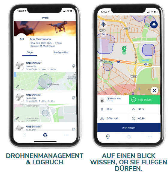 After registering and entering the drone model (many drone models are already preconfigured), the drone class and other data such as the planned maximum flight altitude, flight route and flight duration, this information is used to display on a map where the drone is allowed to fly and under what conditions. The Droniq app includes all common drones and drone brands, but is continuously updated with new models. The app displays on a map (also temporary) no-fly zones (where flying is not allowed) as well as federal highways and freeways, residential areas, cities, residential properties and industrial facilities, nature reserves and airport control zones near airports where special rules apply. Different colors indicate to the pilot where he is allowed to fly (green zones) and where not (red zones). In orange zones, additional aspects apply during the flight, which are listed in the app by tapping the display in the specifications overview. The symbols listed here and colored in orange indicate what the pilot must pay attention to during the current flight - for more detailed information, the user simply has to tap the symbols individually. The app also offers numerous additional features such as a logbook function, operation planning and information on the new drone regulations. 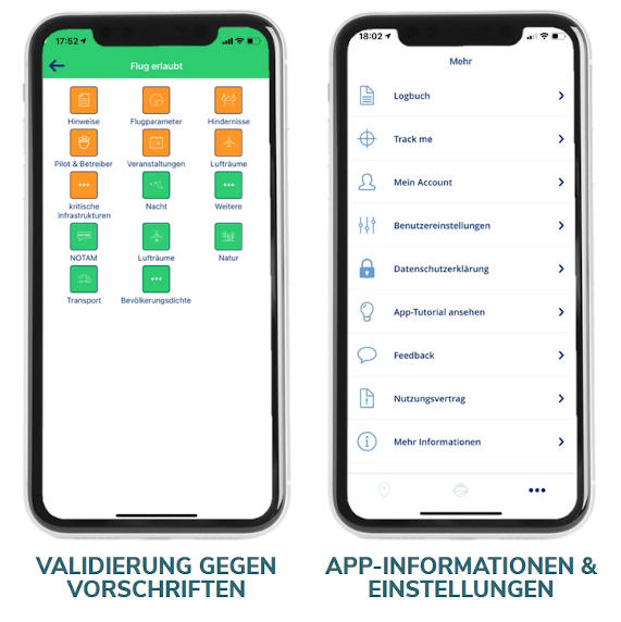 The Droniq app&s features in detail. - Drone/fleet management: selection & registration of drones. - Flight preparation: plan drone flights in Germany - Drone regulation: integration of the new EU regulation for classes A1-A3 - Validation against prohibited zones: Adjustment of radius as well as altitude to validate against prohibited zones - "Fly now" feature: users of the Droniq app will be warned about possible airspace participants flying in the near vicinity and using the app - Information layer: All legal map layers such as airspaces, airports, NOTAM etc.. can be shown or hidden. - Weather: Display of weather data per location - Different background maps: standard, dark, satellite - Logbook: Overview, about already performed flights (drone, time, date and location). There is the Droniq app for deutsche Version dieser Seite: Wo darf ich mit meiner Drohne fliegen? Kostenlose App Droniq gibt die Antwort |
|
|